Hey Utah Jazz players and staff,
I think I speak on behalf of an overwhelming number of Utahns when I say we're thrilled you're here, and genuinely love seeing you all connect with this place. In end-of-season interviews, many of you referenced that you'd spend a lot of the offseason here, preparing together for an important season. And you weren't lying! That's awesome!
It also means that at some point this summer, someone's going to suggest you head up Ensign Peak for the obligatory group photo. It's a short but shadeless hike that's close to downtown, and it provides cool views of downtown and the valley. But... and please trust me on this... there are SO. MANY. BETTER. HIKES.
Ensign Peak is an almost treeless mountain with a monument on top, but it's hardly representative of Utah's picturesque mountains. There are literally dozens of close, short, rewarding trails, even if we stay in just a 30 to 40 minute radius from the practice facility. To prove it, here are some of my nearby favorites.
This isn't meant to be a definitive list, just one dude's illustration that there numerous awesome options. Everything here I've either taken my young son on or I've done with him strapped on the back of this glorious, middle-aged dad bod. That said, I certainly encourage everyone to ponder their own limits when it comes to difficulty level. Most importantly, all of these will make you feel like you're actually in the mountains, not just hiking up a non-descript hill at the edge of a city.
Disclaimers: Research hikes and difficulty levels on your own. Be mindful of wildlife[fn]The "oh look, cool!" kind and the "holy crap, watch out!" kind.[/fn], and remember to check which trails allow pets and which ones don't because they are part of our water supply. Remember that we're a high desert, hydration is a must. Above all, be safe!
---
You won't find a drop of water on Ensign Peak. On the other hand, these waterfall hikes start about a half hour from the practice facility.
Donut Falls
A classic. A waterfall has carved a hole in the roof of a mountain cave, and you can get to it on a really easy hike that's just 1.5 miles round trip if you score parking in the closer lot. (AllTrails says 3.4 miles if you have to walk in from the main road.) There are river crossings, a well-shaded trail, frequent wildlife sightings, and more. Be mindful of the private property adjacent to the trail area, and also know that there will be signs discouraging you from scrambling up over slipperyi boulders to get right next to the waterfall.
Honestly, there are so many great alternatives up Big Cottonwood Canyon. Lake Mary is a short-but-steep hike at Brighton Ski Resort. Silver Lake isn't really a "hike" at all, but a pleasant, flat, one-mile loop around a mountain lake where moose sightings are not uncommon. From the back of Silver you can hike to Lake Solitude or Twin Lakes. And whatever hike you choose up BCC, stop at the "S"-curve on the way down the canyon and you're less than 100 yards away from adding a bonus waterfall to your day: Hidden Falls is right off the road.
Gloria Falls
One of my favorite Little Cottonwood hikes that you can do in a couple hours or less is Gloria Falls. It shares a trailhead with the longer White Pine and Red Pine Lake trails, but this little offshoot to Gloria can be done in just over a mile each way. There are trees everywhere, it's creek-adjacent, and the decent-sized falls are a nice payoff, especially earlier in the season.
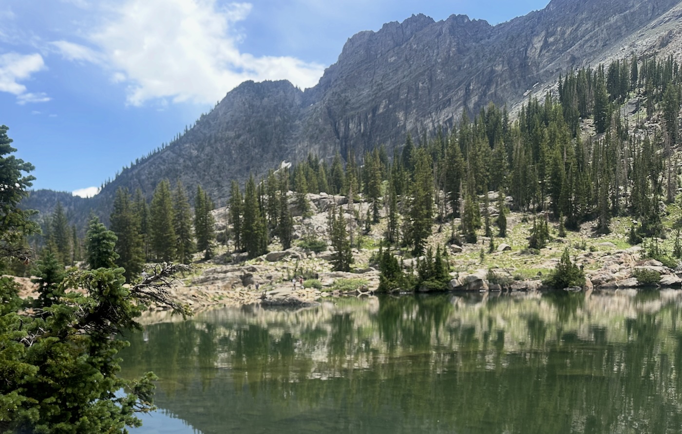
With more time, the White/Red trail systems have so many gorgeous spots, even if you don't go all the way to the lakes, or the wildflowers up at Albion Basin or on the short Cecret Lake hike (1.8 miles round trip) are also a highlight. (The picture above this article is from Cecret Lake.)
Heughs Canyon
Heughs starts in a Holladay neighborhood and follows a babbling creek up to a nice 25-foot waterfall. It's 3.3 miles round trip, but rated easy. There are some rocky areas, but the incline isn't insane.
---
If it's the valley views you're after, but your bored with the yearly trips up Ensign...
SLC overlook via Desolation Trail
This is the hike Will Hardy and Lauri Markkanen did for a 2024 teaser video about the club's return to mountain imagery. It's almost entirely shaded, has enough incline to feel like a decent challenge, but can be done fairly quickly.
Another (longer) option for views is right across the Millcreek Canyon road: the Churck Fork trail up to Grandeur Peak. This 7-miler[fn]Closer to 5.5 round trip if you can park at the top of the Church Fork day use area.[/fn] takes you past a nice waterfall and then along a creek for the first mile. Then the trails veers away from the creek as some switchbacks take you up to a ridge you'll follow to Grandeur. It's the lowest of the peaks in this stretch of the Wasatch range, but still has awesome views.
Bell Canyon
There are great valley views on the popular Bell Canyon trail system in Sandy, too. It only takes a half mile or so to reach the lower of two reservoirs, but you can keep going past that to get to the very popular waterfall. It's around 4.5 miles round trip to go to the falls, and with a pretty serious elevation gain.
Ferguson Canyon
Just outside Big Cottonwood is an opening into this smaller canyon. You'll have impressive valley views for the first 100 yards or so while you walk from the parking area up to the water tower, then you'll zigzag through trees before getting to the some awesome rocky areas. Massive walls of granite create several little amphitheatre-like rooms. The canyon is tight enough that it is well-shaded and stays fairly cool. If you do the full 3.4-mile round trip you'll get to another, higher viewpoint, but honestly just wandering through the rock chambers is pretty cool.
---
Lest I be accused of being too Salt Lake County-centric...
While we're at it...
I really tried to limit the options to stuff within 30-40 minutes of SLC proper... but as long as we're talking about it, we might as well cover some farther-out options.
Canyons in adjacent counties. If you're not up for a full-on day trip but are OK leaving Salt Lake County, our neighbors to the north and south also have some cool canyons to explore. Up north, Adams Canyon (Layton) and Waterfall Canyon (Ogden) are similar in length, but the latter is much steeper. Down in Utah County, I personally find American Fork Canyon to be my favorite. There are dozens of hikes there, but for something unique, get reservations for a Timpanogos Cave tour. In Provo Canyon, the two-tiered Stewart Falls is a stunning reward for just a 3.5-mile hike that's considered family-friendly.
Skull Crack at Causey Reservoir. About an hour from the Delta Center is Causey Reservoir, a popular spot for paddlers[fn]Motorized boats are not allowed, making it prime territory for kayakers and SUPs.[/fn] because of the dramatic, steep canyon is fills. If you make the 2.5-mile (each way) trek to the back of Causey on the Skull Crack trail in the right time of August or early September, you'll see hundreds of bright pink Kokanee salmon. It's also really nice to paddle back there, but try to be headed back before the evening breeze comes up the canyon and makes the paddling harder.
Uintas. The highest points in Utah all belong in the towering Uinta mountains, past Park City. A good starting point is the Mirror Lake Highway, which starts just 45 minutes from Salt Lake in Kamas. On the near side of the highway, one of my favorite spots is the Upper Provo Falls area, about a half hour up the highway from Kamas. A short walk from the parking area takes you to a scenic waterfall and an area you can splash around in. This isn't watershed, so bring a swimsuit or some quick-dry stuff and plan to cool off. Or continue east over the Bald Mountain pass and go drop paddleboards (I'll loan you mine!) in Mirror Lake, or the U-shaped Butterfly Lake, or Pass Lake, or Lily Lake, or.... you get the picture.
National Parks. I mean, as long as you're living in a state that has five national parks, might as well take a couple days and go explore them. Because of the summer heat and crowds at Arches, Canyonlands and Zion, I'd say start with Bryce Canyon National Park. It's easy to check out the breathtaking collection of "hoodoos" (rock formations) from the viewing areas along the canyon rim, but there are also options for hikers who want to descend down into the sea of spires. The quintessential below-the-rim hike is the Queen's Garden-Navajo combo loop trail. What goes down must come up, so be mentally prepared for a steep climb up the "Wall Street" switchbacks at the end... but it's worth it.
Capitol Reef is also overlooked and underrated. My favorites there for casual hikers are Hickman Bridge (2 miles round trip) and the harder Cassidy Arch hike (3.3 miles but with a serious incline). Arches and Canyonlands have iconic spots but get really warm, and people who visit Zion in May-August spend most of their time waiting at crowded shuttle stops because they no longer allow private vehicles past certain points.
-----
You get to live, work and bounce a basketball around in a truly special place. I grew up here, but spent several years in the concrete jungle, which really helped me appreciate my return to a unique, medium-sized city that has breathtaking mountains just minutes away.
I sincerely hope while you're here (especially in the summer) you get to experience some of that.